GDAL/OGR
About
Geospatial Data Abstraction Library (GDAL/OGR) is a cross-platform C++ translator library for raster and vector geospatial data formats that is released under an X/MIT style Open Source license by the Open Source Geospatial Foundation. As a library, it presents a single abstract data model to the calling application for all supported formats. It also comes with a variety of useful command line utilities for data translation and processing. GDAL supports over 50 raster formats, and OGR over 20 vector formats.
In Boundless Desktop installation, GDAL/OGR utilities are available through QGIS or the installed Command Shell. The shipped version of GDAL/OGR includes two extra libraries, LibKML and OpenJPEG2, for .kmz and JPEG2000 support, respectively.
Quick start guide
GDAL/OGR is a suite of command line programs that can be launched through the Command Shell. Command Shell can be found in the Boundless Desktop folder.
Download the data for this quick start
hereand unzip it anywhere you think it’s convenient.Open Command Shell using any of the available shortcuts in your computer.
If you are on Windows, you will immediately see the list of available commands. To list them again, type
o-helpand pressEnter. To print the list of available commands on Mac, typelist-cmdsand pressEnter.To execute a GDAL/OGR command, type its name an press enter. If executed without arguments GDAL/OGR commands normally print a short help text that can also be accessed with –help option, for example:
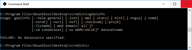
gdalinfo --help
To print all information on the shapefile events.shp contained in the sample data, navigate to the location of the unzipped quick start data and run the following:
ogrinfo -al events.shp
The output of the command is:
INFO: Open of `events.shp'
      using driver `ESRI Shapefile' successful.

Layer name: events
Geometry: Point
Feature Count: 1
Extent: (7.123115, 50.718396) - (7.123115, 50.718396)
Layer SRS WKT:
GEOGCS["GCS_WGS_1984",
    DATUM["WGS_1984",
        SPHEROID["WGS_84",6378137,298.257223563]],
    PRIMEM["Greenwich",0],
    UNIT["Degree",0.017453292519943295]]
name: String (80.0)
venue: String (80.0)
start_date: Date (10.0)
end_date: Date (10.0)
OGRFeature(events):0
  name (String) = FOSS4G 2016
  venue (String) = World Conference Center Bonn
  start_date (Date) = 2016/08/21
  end_date (Date) = 2016/08/26
  POINT (7.12311523114681 50.718396029588526)
To convert the shapefile events.shp to a different coordinate reference system (UTM 33N) and save it to a different format (MapInfo) you can use ogr2ogr:
ogr2ogr -t_srs EPSG:32633 -f "MapInfo File" events_32633.tab events.shp
To check the transformed data you can use ogrinfo:
ogrinfo -al events_32633.tab
The output of the command is:
Had to open data source read-only.
INFO: Open of `events_32633.tab'
      using driver `MapInfo File' successful.

Layer name: events_32633
Geometry: Point
Feature Count: 1
Extent: (-55706.115697, 5648162.052998) - (-55706.115697, 5648162.052998)
Layer SRS WKT:
PROJCS["unnamed",
    GEOGCS["unnamed",
        DATUM["WGS_1984",
            SPHEROID["WGS 84",6378137,298.257223563],
            TOWGS84[0,0,0,0,0,0,0]],
        PRIMEM["Greenwich",0],
        UNIT["degree",0.0174532925199433]],
    PROJECTION["Transverse_Mercator"],
    PARAMETER["latitude_of_origin",0],
    PARAMETER["central_meridian",15],
    PARAMETER["scale_factor",0.9996],
    PARAMETER["false_easting",500000],
    PARAMETER["false_northing",0],
    UNIT["Meter",1.0]]
name: String (80.0)
venue: String (80.0)
start_date: Date (10.0)
end_date: Date (10.0)
OGRFeature(events_32633):1
  name (String) = FOSS4G 2016
  venue (String) = World Conference Center Bonn
  start_date (Date) = 2016/08/21
  end_date (Date) = 2016/08/26
  Style = SYMBOL(a:0,c:#000000,s:12pt,id:"mapinfo-sym-35,ogr-sym-10")
  POINT (-55706.115697181601718 5648162.052997644990683)
Online resources
- Official Site: http://www.gdal.org/
- GDAL Raster Utilities: http://www.gdal.org/gdal_utilities.html
- OGR Vector Utilities: http://www.gdal.org/ogr_utilities.html